File:Detailed map of West Mansfield, Ohio.png
Jump to navigation
Jump to search
No higher resolution available.
Detailed_map_of_West_Mansfield,_Ohio.png (575 × 425 pixels, file size: 17 KB, MIME type: image/png)
File history
Click on a date/time to view the file as it appeared at that time.
| Date/Time | Thumbnail | Dimensions | User | Comment | |
|---|---|---|---|---|---|
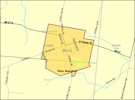
| current | 14:28, 14 December 2008 | | 575 × 425 (17 KB) | commons>Nyttend | {{Information |Description=Map of {{w|West Mansfield, Ohio|West Mansfield}}, a village in {{w|Logan County, Ohio|Logan County}}, {{w|Ohio}}, {{w|United States}}, with its boundaries at the time of the {{w|2000 United States Census|2000 census}}. |Source=h |
File usage
There are no pages that use this file.