File:Darjeeling Hills.jpg
Jump to navigation
Jump to search
Size of this preview: 483 × 600 pixels. Other resolutions: 193 × 240 pixels | 387 × 480 pixels | 974 × 1,209 pixels.
Original file (974 × 1,209 pixels, file size: 525 KB, MIME type: image/jpeg)
Summary
| Description |
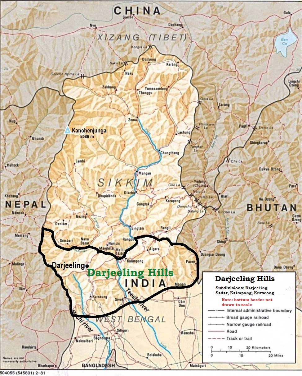
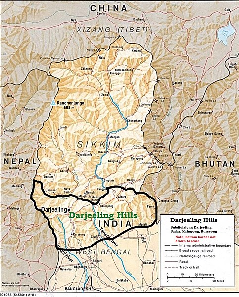
English: Darjeeling Hills showing Darjeeling, Kalimpong, and Kurseong (map drawn by Fowler&fowler (talk) 12:58, 29 July 2022 (UTC)) |
| Date | |
| Source | https://maps.lib.utexas.edu/maps/middle_east_and_asia/sikkim.jpg |
| Author | US Central Intelligence Agency |
Licensing
This work is in the public domain in the United States because it is a work prepared by an officer or employee of the United States Government as part of that person’s official duties under the terms of Title 17, Chapter 1, Section 105 of the US Code.
Note: This only applies to original works of the Federal Government and not to the work of any individual U.S. state, territory, commonwealth, county, municipality, or any other subdivision. This template also does not apply to postage stamp designs published by the United States Postal Service since 1978. (See § 313.6(C)(1) of Compendium of U.S. Copyright Office Practices). It also does not apply to certain US coins; see The US Mint Terms of Use.
|
 | |
| This file has been identified as being free of known restrictions under copyright law, including all related and neighboring rights. | ||
File history
Click on a date/time to view the file as it appeared at that time.
| Date/Time | Thumbnail | Dimensions | User | Comment | |
|---|---|---|---|---|---|
| current | 12:58, 29 July 2022 | | 974 × 1,209 (525 KB) | commons>Fowler&fowler | Uploaded a work by US Central Intelligence Agency from https://maps.lib.utexas.edu/maps/middle_east_and_asia/sikkim.jpg with UploadWizard |
File usage
There are no pages that use this file.