File:DC satellite image.jpg
Jump to navigation
Jump to search

Size of this preview: 512 × 599 pixels. Other resolutions: 205 × 240 pixels | 410 × 480 pixels | 656 × 768 pixels | 1,230 × 1,440 pixels.
Original file (1,230 × 1,440 pixels, file size: 2.9 MB, MIME type: image/jpeg)
Summary
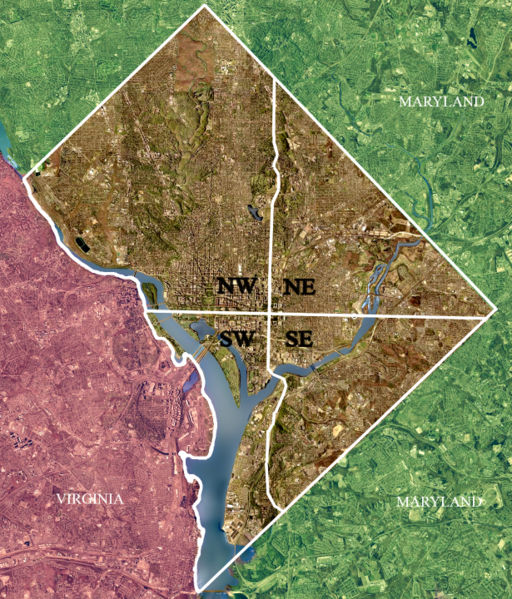
| Description | USGS satellite image of the District of Columbia, modified to show territorial boundary and quadrant divisions. |
| Date | Taken on 26 April 2002 |
| Source | USGS satellite image |
| Author | USGS, modified by User:Postdlf |
| Other versions |
|
.jpg)
.jpg)

Licensing
This image is in the public domain in the United States because it only contains materials that originally came from the United States Geological Survey, an agency of the United States Department of the Interior. For more information, see the official USGS copyright policy.
|
File history
Click on a date/time to view the file as it appeared at that time.
| Date/Time | Thumbnail | Dimensions | User | Comment | |
|---|---|---|---|---|---|
| current | 14:41, 1 November 2006 | | 1,230 × 1,440 (2.9 MB) | commons>Urban~commonswiki | Uploaded from : http://upload.wikimedia.org/wikipedia/en/d/d7/DC_satellite_image.jpg == Summary == USGS satellite image of Washington, D.C. taken April 26, 2002, modified to show territorial boundary and quadrant di |
File usage
There are no pages that use this file.