File:Chicago Demographics in 1950 Map.jpg
Jump to navigation
Jump to search
Size of this preview: 400 × 599 pixels. Other resolutions: 160 × 240 pixels | 320 × 480 pixels | 513 × 768 pixels | 683 × 1,024 pixels | 1,984 × 2,972 pixels.
Original file (1,984 × 2,972 pixels, file size: 1.28 MB, MIME type: image/jpeg)
File history
Click on a date/time to view the file as it appeared at that time.
| Date/Time | Thumbnail | Dimensions | User | Comment | |
|---|---|---|---|---|---|
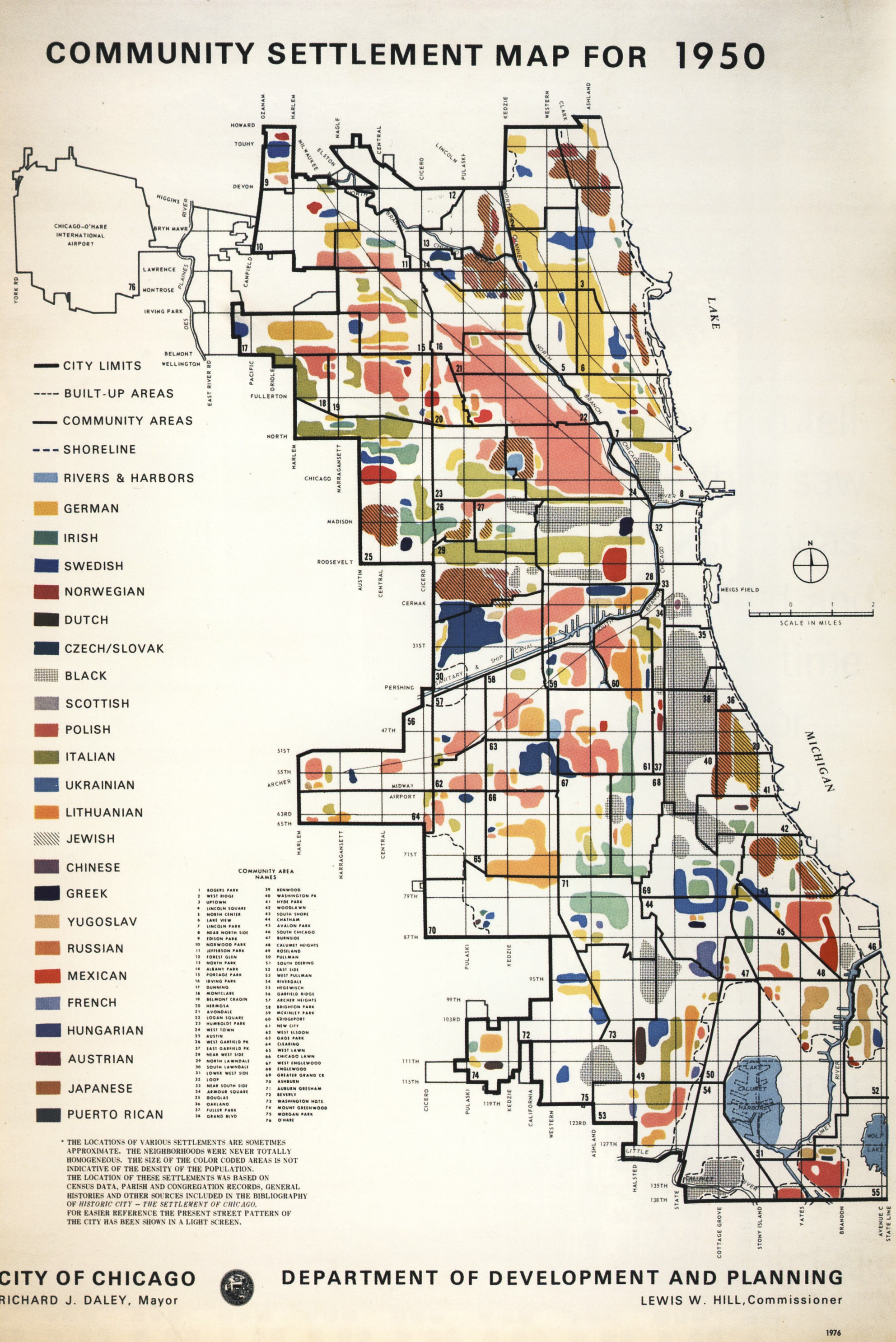
| current | 02:55, 8 June 2009 | | 1,984 × 2,972 (1.28 MB) | commons>Orestek | {{Information |Description={{en|1=Map illustrating the dominant ethnicities of different areas of Chicago in 1950}} {{pl|1=Mapa ukazujaca rozmieszczenie poszczegolnych narodowosci w Chicago w r. 1950.}} |Source=City of Chicago Department of Planning and D |
File usage
There are no pages that use this file.