File:Chiaves-map-xuala-1584.jpg
Jump to navigation
Jump to search
No higher resolution available.
Chiaves-map-xuala-1584.jpg (442 × 257 pixels, file size: 35 KB, MIME type: image/jpeg)
File history
Click on a date/time to view the file as it appeared at that time.
| Date/Time | Thumbnail | Dimensions | User | Comment | |
|---|---|---|---|---|---|
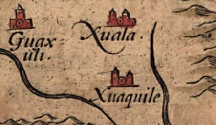
| current | 19:38, 3 July 2008 | | 442 × 257 (35 KB) | commons>BrineStans | {{Information |Description={{en|1=Detail of the Native American village of Joara (spelled "Xuala" on the map) and two neighboring villages in what is now North Carolina, in the southeastern United States, [http://commons.wikimedia.org/wiki/Image:Chiaves-l |
File usage
There are no pages that use this file.