File:CheyenneCourseWatershed1.png
Jump to navigation
Jump to search

Size of this preview: 800 × 557 pixels. Other resolutions: 320 × 223 pixels | 640 × 446 pixels | 814 × 567 pixels.
Original file (814 × 567 pixels, file size: 43 KB, MIME type: image/png)
File history
Click on a date/time to view the file as it appeared at that time.
| Date/Time | Thumbnail | Dimensions | User | Comment | |
|---|---|---|---|---|---|
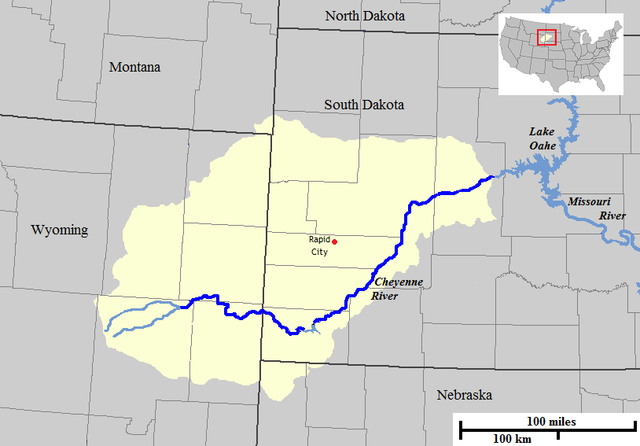
| current | 08:09, 1 February 2009 | | 814 × 567 (43 KB) | commons>AlexiusHoratius~commonswiki | {{Information |Description={{en|1=Map of the course and watershed of the Cheyenne River in the United States. }} |Source=Base map used was taken from the [http://www.nationalatlas.gov/natlas/Natlasstart.asp National Atlas], remaining work was done by the |
File usage
There are no pages that use this file.