File:Champlainmap fr.svg
Jump to navigation
Jump to search

Size of this PNG preview of this SVG file: 465 × 470 pixels. Other resolutions: 237 × 240 pixels | 475 × 480 pixels | 760 × 768 pixels | 1,013 × 1,024 pixels | 2,026 × 2,048 pixels.
Original file (SVG file, nominally 465 × 470 pixels, file size: 99 KB)
File history
Click on a date/time to view the file as it appeared at that time.
| Date/Time | Thumbnail | Dimensions | User | Comment | |
|---|---|---|---|---|---|
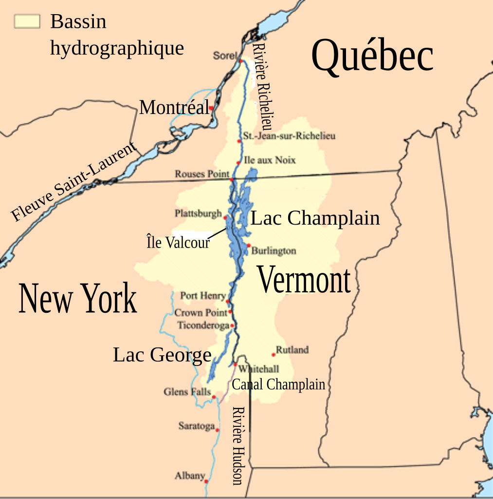
| current | 02:00, 26 December 2011 | | 465 × 470 (99 KB) | commons>Pierre cb | == {{int:filedesc}} == {{Information |Description=Cette carte montre le bassin hydrographique du Lac Champlain et de la rivière Richelieu. L'auteur original a utilisé les données du [[:fr:United States |
File usage
There are no pages that use this file.