File:Cedar Grove, State Route 609, Providence Forge vicinity (New Kent County, Virginia).jpg
Jump to navigation
Jump to search
Size of this preview: 767 × 599 pixels. Other resolutions: 307 × 240 pixels | 614 × 480 pixels | 874 × 683 pixels.
Original file (874 × 683 pixels, file size: 190 KB, MIME type: image/jpeg)
|
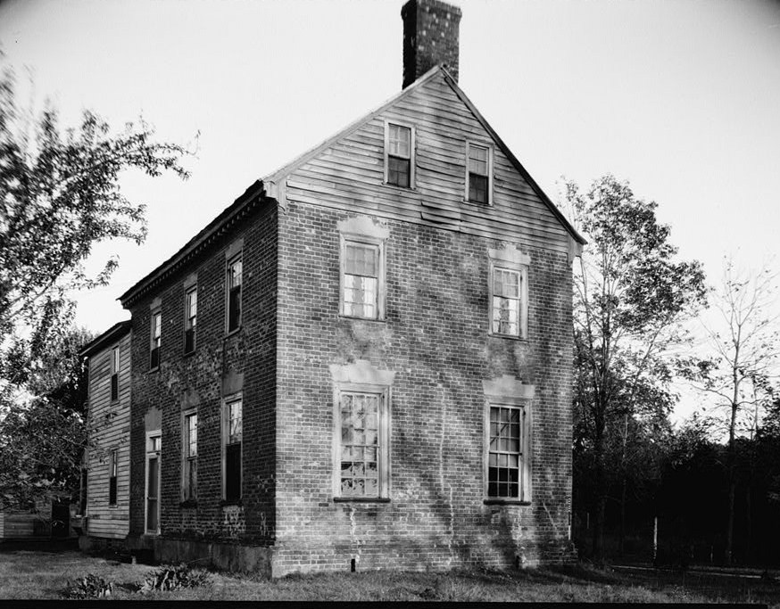
This is an image of a place or building that is listed on the National Register of Historic Places in the United States of America. Its reference number is 79003058. |
| Description |
English: Cedar Grove, State Route 609, Providence Forge vicinity (New Kent County, Virginia)
cropped HABS VA,64-PROFO.V,1-1
|
|||||||||
| Date | Unknown date | |||||||||
| Source | http://memory.loc.gov/pnp/habshaer/va/va0700/va0773/photos/163930pv.jpg | |||||||||
| Author | Unknown author |

.jpg)
.jpg¶ms=037.485278_N_-077.115833_E_globe:Earth_class:object_region:US_type:landmark_scale:1500_&language=en)
File history
Click on a date/time to view the file as it appeared at that time.
| Date/Time | Thumbnail | Dimensions | User | Comment | |
|---|---|---|---|---|---|
| current | 13:28, 17 December 2010 | | 874 × 683 (190 KB) | commons>KudzuVine | {{Information |Description={{en|1=Cedar Grove, State Route 609, Providence Forge vicinity (New Kent County, Virginia) cropped HABS VA,64-PROFO.V,1-1 {{PD-USGov-Interior-HABS|VA-802}}}} |Source=http://memory.loc.gov/pnp/habshaer/va/va0700/va0773/photos/16 |
File usage
There are no pages that use this file.
.jpg)