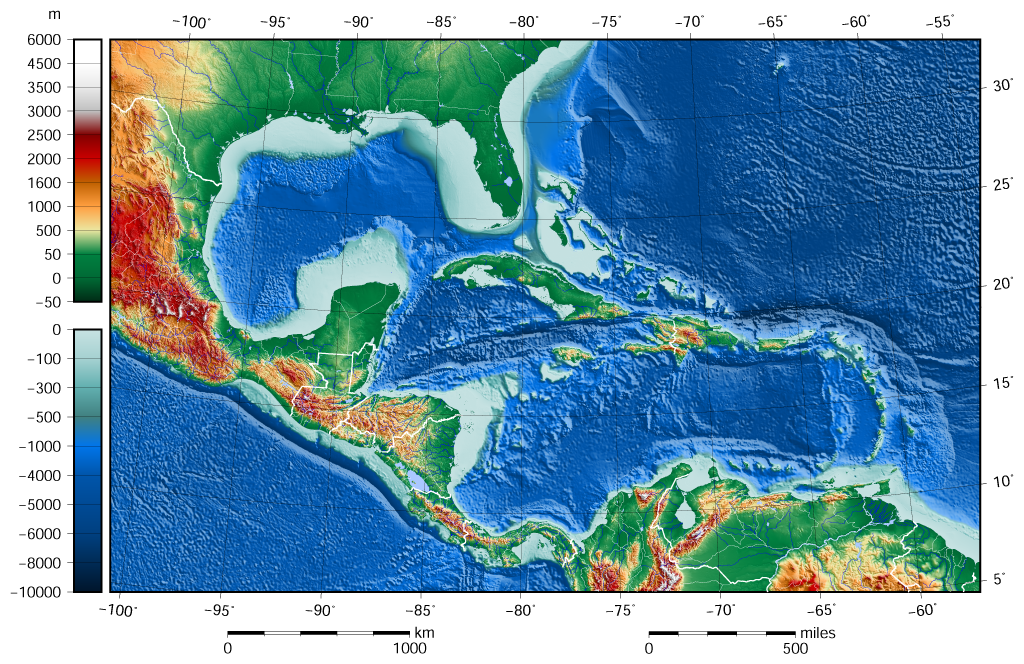
File:Caribbean Sea Gulf of Mexico shaded relief bathymetry land map.png
Jump to navigation
Jump to search
Size of this preview: 800 × 519 pixels. Other resolutions: 320 × 208 pixels | 640 × 415 pixels | 1,024 × 664 pixels.
Original file (1,024 × 664 pixels, file size: 1.1 MB, MIME type: image/png)
File history
Click on a date/time to view the file as it appeared at that time.
| Date/Time | Thumbnail | Dimensions | User | Comment | |
|---|---|---|---|---|---|
| current | 09:58, 8 June 2015 | | 1,024 × 664 (1.1 MB) | commons>Darekk2 | added lakes ... and changed palette for land (white highest mountains) |
File usage
There are no pages that use this file.