File:Brittain 410.jpg
Jump to navigation
Jump to search
Size of this preview: 445 × 600 pixels. Other resolutions: 178 × 240 pixels | 356 × 480 pixels | 570 × 768 pixels | 1,111 × 1,497 pixels.
Original file (1,111 × 1,497 pixels, file size: 369 KB, MIME type: image/jpeg)
File history
Click on a date/time to view the file as it appeared at that time.
| Date/Time | Thumbnail | Dimensions | User | Comment | |
|---|---|---|---|---|---|
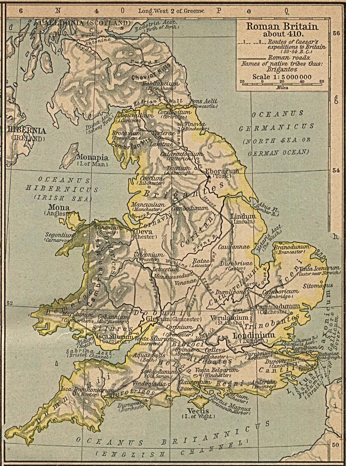
| current | 15:24, 3 December 2005 | | 1,111 × 1,497 (369 KB) | commons>Migdejong | Map of the isle Great Brittain in the year 410. Image comes from the University of Texas at Austin: http://geography.about.com/gi/dynamic/offsite.htm?site=http://www.lib.utexas.edu/maps/historical/history%5Feurope.html Map is released into the publi |
File usage
There are no pages that use this file.