File:Big Horn Basin Stratigraphy.png
Jump to navigation
Jump to search
Size of this preview: 659 × 600 pixels. Other resolutions: 264 × 240 pixels | 528 × 480 pixels | 709 × 645 pixels.
Original file (709 × 645 pixels, file size: 112 KB, MIME type: image/png)
File history
Click on a date/time to view the file as it appeared at that time.
| Date/Time | Thumbnail | Dimensions | User | Comment | |
|---|---|---|---|---|---|
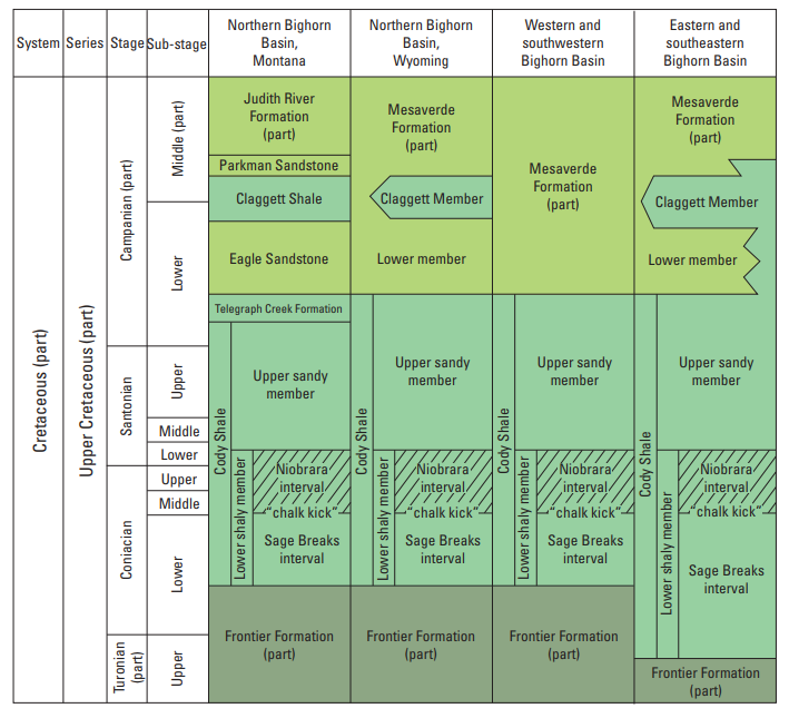
| current | 17:46, 20 July 2023 | | 709 × 645 (112 KB) | commons>Pi3.124 | Uploaded a work by Thomas M. Finn from Structure Contour and Overburden Maps of the Niobrara Interval of the Upper Cretaceous Cody Shale in the Bighorn Basin, Wyoming and Montana, USGS, https://pubs.usgs.gov/sim/3457/sim3457_pamphlet.pdf with UploadWizard |
File usage
There are no pages that use this file.