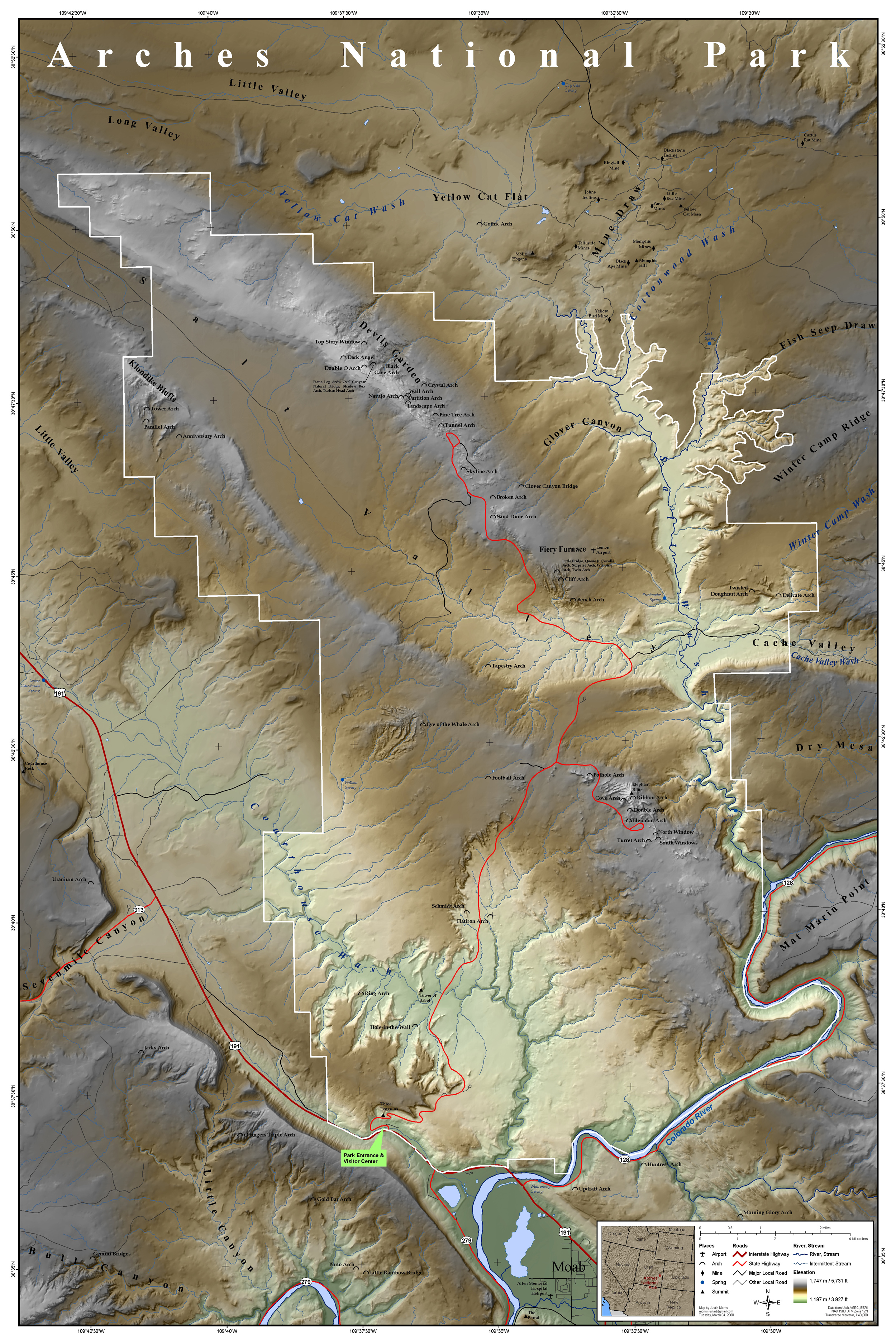
File:Arches National Park Map.jpg
Jump to navigation
Jump to search
Size of this preview: 400 × 600 pixels. Other resolutions: 160 × 240 pixels | 320 × 480 pixels | 512 × 768 pixels | 682 × 1,024 pixels | 2,500 × 3,750 pixels.
Original file (2,500 × 3,750 pixels, file size: 3.52 MB, MIME type: image/jpeg)
File history
Click on a date/time to view the file as it appeared at that time.
| Date/Time | Thumbnail | Dimensions | User | Comment | |
|---|---|---|---|---|---|
| current | 17:15, 16 March 2008 | | 2,500 × 3,750 (3.52 MB) | commons>Justinmorris | {{FeaturedPicture|Arches National Park Map}} == Summary == {{Information |Description=Map of Arches National Park, Utah, United States showing predominant features such as arches, peaks, rivers and streams, mines, and roads. |S |
File usage
There are no pages that use this file.