File:Apaporis drainage basin map-fr.svg
Jump to navigation
Jump to search

Size of this PNG preview of this SVG file: 458 × 600 pixels. Other resolutions: 183 × 240 pixels | 366 × 480 pixels | 586 × 768 pixels | 782 × 1,024 pixels | 1,564 × 2,048 pixels | 1,101 × 1,442 pixels.
Original file (SVG file, nominally 1,101 × 1,442 pixels, file size: 1.47 MB)
File history
Click on a date/time to view the file as it appeared at that time.
| Date/Time | Thumbnail | Dimensions | User | Comment | |
|---|---|---|---|---|---|
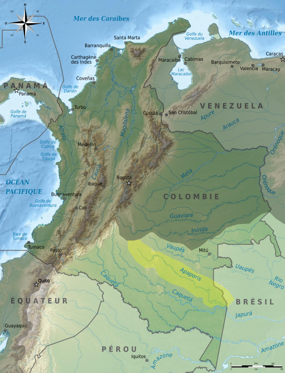
| current | 16:53, 6 March 2011 | | 1,101 × 1,442 (1.47 MB) | commons>Bourrichon | {{Information |Description= {{fr|Carte du bassin versant de l'fr:Apaporis à l'intérieur du bassin versant de l'Amazone, sur une carte de Colombie. Limites approximatives !}} |Source={{Own}} ; travail |
File usage
There are no pages that use this file.