File:Andino regions map.svg
Jump to navigation
Jump to search

Size of this PNG preview of this SVG file: 335 × 599 pixels. Other resolutions: 134 × 240 pixels | 268 × 480 pixels | 429 × 768 pixels | 572 × 1,024 pixels | 1,145 × 2,048 pixels | 493 × 882 pixels.
Original file (SVG file, nominally 493 × 882 pixels, file size: 7.04 MB)
| Description |
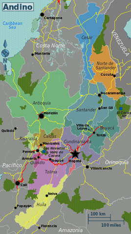
English: Map of the Andino travel region of Colombia |
|||
| Date | ||||
| Source | OpenStreetMap | |||
| Author | Peter Fitzgerald, OpenStreetMap | |||
| Permission (Reusing this file) |
This file is licensed under the Creative Commons Attribution-Share Alike 2.0 Generic license.
|
|||
| Other versions |
PNG versions: |
File history
Click on a date/time to view the file as it appeared at that time.
| Date/Time | Thumbnail | Dimensions | User | Comment | |
|---|---|---|---|---|---|
| current | 00:48, 19 May 2013 | | 493 × 882 (7.04 MB) | commons>Peterfitzgerald | {{Information |Description ={{en|1=Map of the Andino travel region of Colombia}} |Source =[http://openstreetmap.org OpenStreetMap] |Author =Peter Fitzgerald, [http://openstreetmap.org OpenStreetMap] |Date ... |
File usage
There are no pages that use this file.