File:Alboran Sea map.png
Jump to navigation
Jump to search
Size of this preview: 586 × 600 pixels. Other resolutions: 234 × 240 pixels | 469 × 480 pixels | 750 × 768 pixels | 1,000 × 1,024 pixels | 2,000 × 2,047 pixels.
Original file (2,000 × 2,047 pixels, file size: 188 KB, MIME type: image/png)
File history
Click on a date/time to view the file as it appeared at that time.
| Date/Time | Thumbnail | Dimensions | User | Comment | |
|---|---|---|---|---|---|
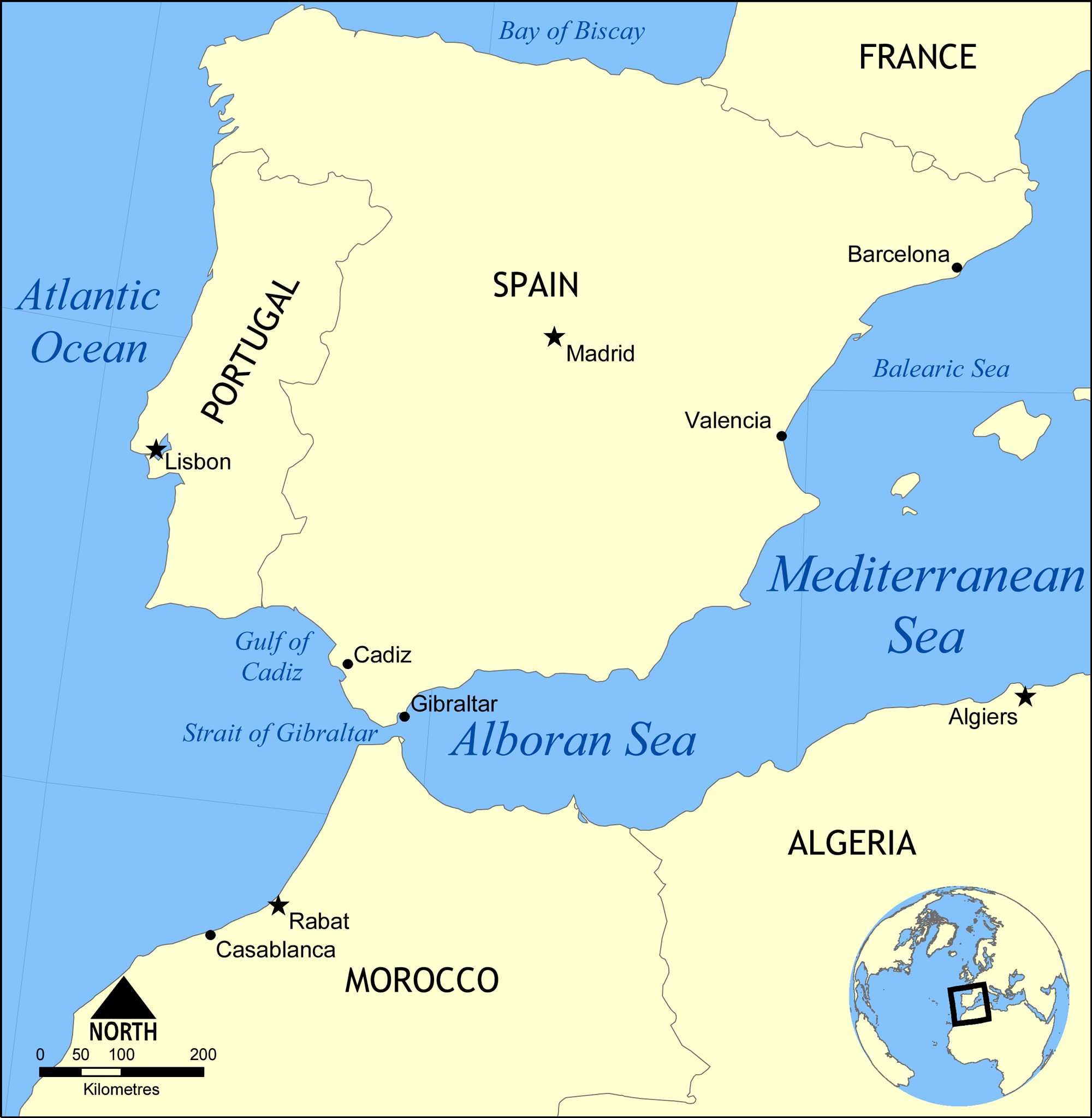
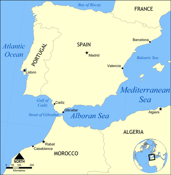
| current | 18:36, 28 January 2009 | | 2,000 × 2,047 (188 KB) | commons>NormanEinstein | {{Information |Description={{en|1=Map showing the location of the Alboran Sea, a part of the Mediterranean Sea, between Spain and Morocco.}} |Source=Own work by uploader |Author=NormanEinstein |Date=2009-01-28 |Permission= |other_v |
File usage
There are no pages that use this file.