File:Aerial views of Odawara Japan.jpg
Jump to navigation
Jump to search

Size of this preview: 800 × 533 pixels. Other resolutions: 320 × 213 pixels | 640 × 427 pixels | 1,024 × 683 pixels | 1,280 × 853 pixels | 2,560 × 1,707 pixels | 5,354 × 3,569 pixels.
Original file (5,354 × 3,569 pixels, file size: 5.52 MB, MIME type: image/jpeg)
Summary
| Description |
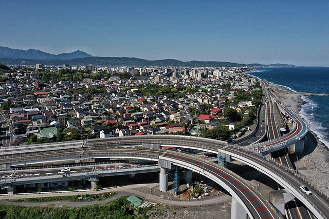
中文:日本小田原天际线(自西向东拍摄),近景为日本国道1号相模湾早川立交。
English: Japanese Odawara skyline (shot from west to east), with the foreground featuring the Sagami Bay Hayakawa Junction on Japan National Route 1.
日本語: 日本の小田原市のスカイライン(西から東に撮影)、手前は日本国道1号の相模湾早川ジャンクションです。 |
| Date | |
| Source | Own work |
| Author | Charlie fong |
| Camera location | | View this and other nearby images on: OpenStreetMap |
|---|
Licensing
I, the copyright holder of this work, hereby publish it under the following license:
This file is licensed under the Creative Commons Attribution-Share Alike 4.0 International license.
- You are free:
- to share – to copy, distribute and transmit the work
- to remix – to adapt the work
- Under the following conditions:
- attribution – You must give appropriate credit, provide a link to the license, and indicate if changes were made. You may do so in any reasonable manner, but not in any way that suggests the licensor endorses you or your use.
- share alike – If you remix, transform, or build upon the material, you must distribute your contributions under the same or compatible license as the original.
File history
Click on a date/time to view the file as it appeared at that time.
| Date/Time | Thumbnail | Dimensions | User | Comment | |
|---|---|---|---|---|---|
| current | 14:06, 12 May 2024 | | 5,354 × 3,569 (5.52 MB) | commons>Charlie fong | Uploaded own work with UploadWizard |
File usage
There are no pages that use this file.