File:Aerial view Louisiana flooding August 2016 USGS.jpg
Jump to navigation
Jump to search

Size of this preview: 800 × 254 pixels. Other resolutions: 320 × 101 pixels | 1,180 × 374 pixels.
Original file (1,180 × 374 pixels, file size: 169 KB, MIME type: image/jpeg)
File history
Click on a date/time to view the file as it appeared at that time.
| Date/Time | Thumbnail | Dimensions | User | Comment | |
|---|---|---|---|---|---|
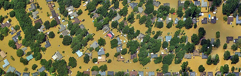
| current | 01:56, 9 February 2019 | 1,180 × 374 (169 KB) | commons>42Squire | Aerial imagery of flooding in Louisiana. Image created by Jason Burton, USGS, using aerial imagery taken by NOAA aviators on behalf of the National Geodetic Survey. Available at https://www.usgs.gov/media/images/ngs-aerial-imagery-louisiana-flooding Date Taken: Thursday, August 18, 2016 In the public domain as a work of the U.S. Geological Survey. |
File usage
There are no pages that use this file.