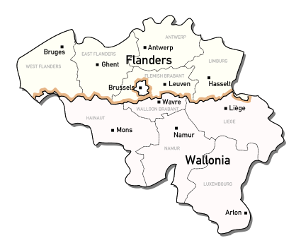
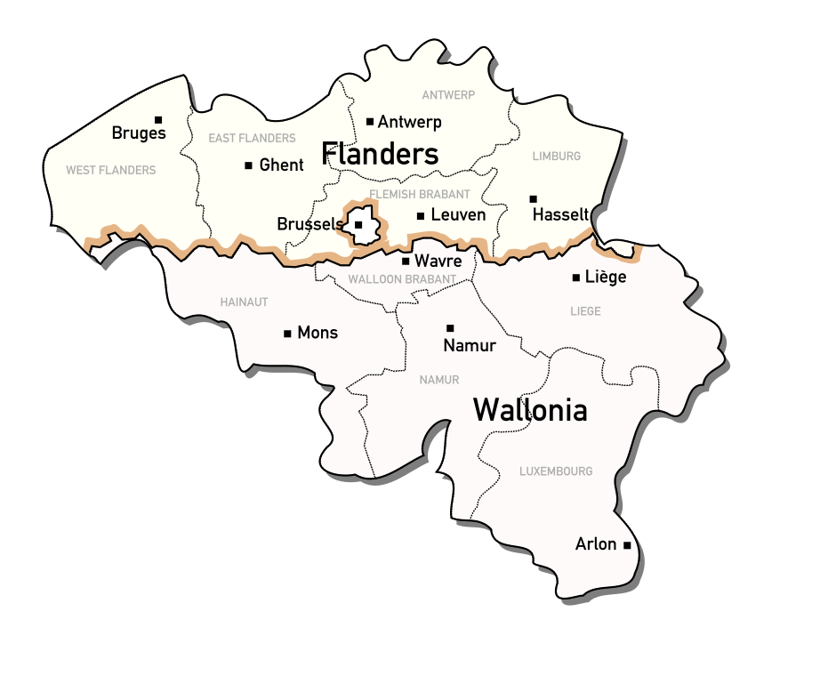
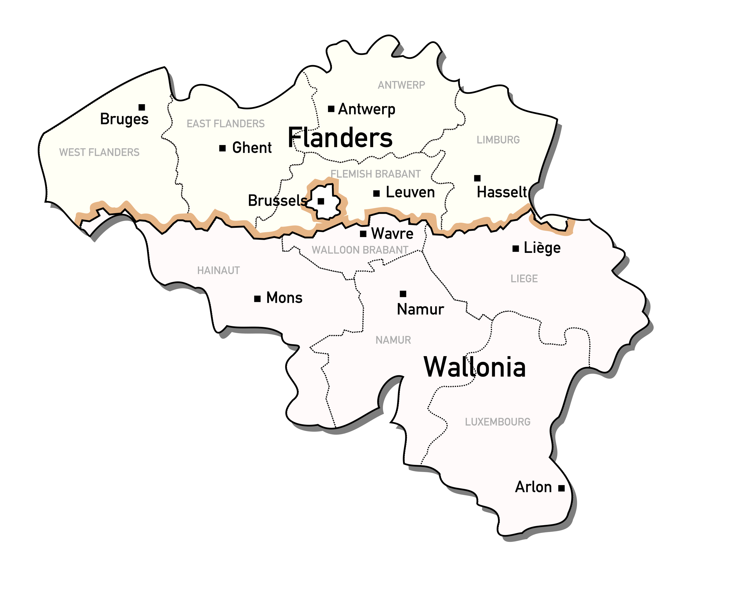
File:Administrative regions of Belgium.svg
Jump to navigation
Jump to search

Size of this PNG preview of this SVG file: 425 × 354 pixels. Other resolutions: 288 × 240 pixels | 576 × 480 pixels | 922 × 768 pixels | 1,229 × 1,024 pixels | 2,459 × 2,048 pixels.
Original file (SVG file, nominally 425 × 354 pixels, file size: 188 KB)
File history
Click on a date/time to view the file as it appeared at that time.
| Date/Time | Thumbnail | Dimensions | User | Comment | |
|---|---|---|---|---|---|
| current | 10:23, 16 October 2006 | | 425 × 354 (188 KB) | commons>Michiel Buddingh'~commonswiki | {{Information |Description = Map of the Administrative regions of Belgium |Source = Based on a GFDL Wikipedia image: {{srlink|Wikipedia:Image:350px-Belgium_RegProv_border.jpg}} |Date = 2006-10-16 |Author = User:Michiel_Buddingh' |Permission = See be |
File usage
There are no pages that use this file.