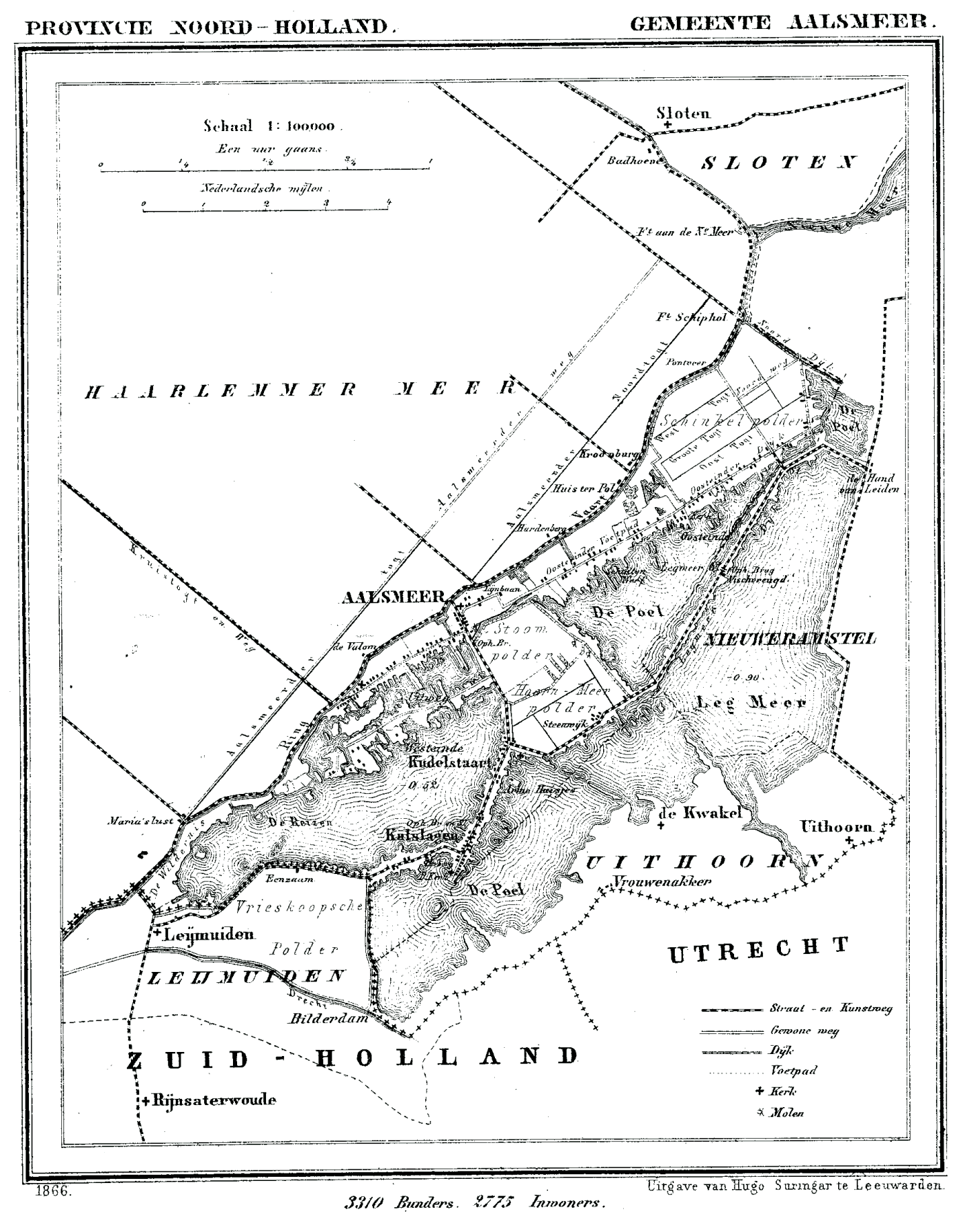
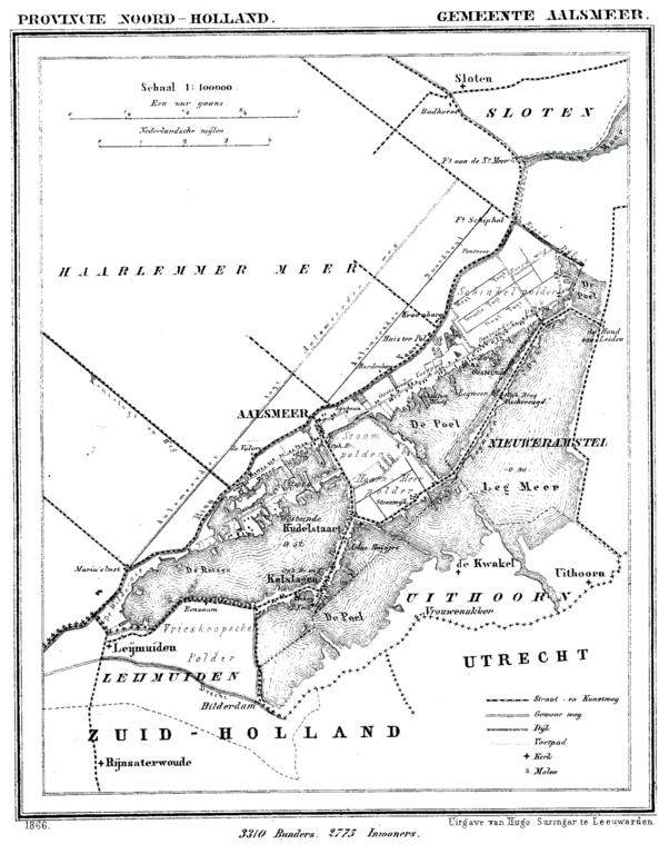
File:Aalsmeer 1866.png
Jump to navigation
Jump to search
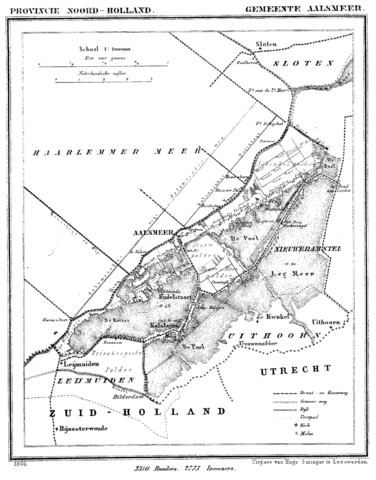
Size of this preview: 470 × 600 pixels. Other resolutions: 188 × 240 pixels | 376 × 480 pixels | 602 × 768 pixels | 803 × 1,024 pixels | 1,400 × 1,786 pixels.
Original file (1,400 × 1,786 pixels, file size: 234 KB, MIME type: image/png)
File history
Click on a date/time to view the file as it appeared at that time.
| Date/Time | Thumbnail | Dimensions | User | Comment | |
|---|---|---|---|---|---|
| current | 15:13, 2 January 2008 | | 1,400 × 1,786 (234 KB) | commons>P199 | {{Information |Description=Historic map of Aalsmeer, North Holland, the Netherlands |Source=Gemeente Atlas van Nederland (Municipal Atlas of the Netherlands) |Date=1865-1870 |Author=J. Kuyper |Permission= |other_versions= }} == Licensing == {{PD-old}} [ |
File usage
There are no pages that use this file.