File:7 Brocolitia.png
Jump to navigation
Jump to search

Size of this preview: 800 × 400 pixels. Other resolutions: 320 × 160 pixels | 640 × 320 pixels.
Original file (1,200 × 600 pixels, file size: 1.67 MB, MIME type: image/png)
Summary
| Description |
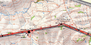
English: OS Map of Hadrian's Wall, in Northern England, at a scale of 1:31,680 or two inches to one mile |
| Date | |
| Source | Scan of original OS map |
| Author | Director General of the Ordnance Survey, UK |
Licensing
This work is an Ordnance Survey map over 50 years old, which is covered by Crown Copyright which in this case expires 50 years after publication. Ordnance Survey does however ask that they be credited and that the date of publication be given.
Any ancillary rights gained through the creation of the electronic version are granted as freely usable under any circumstances.
|
This work created by the United Kingdom Government is in the public domain.
This is because it is one of the following:
HMSO has declared that the expiry of Crown Copyrights applies worldwide (ref: HMSO Email Reply)
|
 |
File history
Click on a date/time to view the file as it appeared at that time.
| Date/Time | Thumbnail | Dimensions | User | Comment | |
|---|---|---|---|---|---|
| current | 20:50, 2 August 2019 | | 1,200 × 600 (1.67 MB) | commons>ColdEel | User created page with UploadWizard |
File usage
There are no pages that use this file.