File:2002 United States House of Representatives election in OK-05.svg
Jump to navigation
Jump to search

Size of this PNG preview of this SVG file: 559 × 493 pixels. Other resolutions: 272 × 240 pixels | 544 × 480 pixels | 871 × 768 pixels | 1,161 × 1,024 pixels | 2,322 × 2,048 pixels.
Original file (SVG file, nominally 559 × 493 pixels, file size: 582 KB)
Summary
| Description |
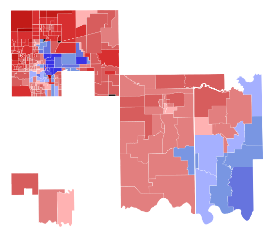
English: Results of the 2002 election in Oklahoma's 3rd congressional district. Data provided by OpenElections. Precinct shapefile from the University of Oklahoma Center for Spatial Analysis. Early and absentee votes were formulaically allocated from the county level to the precinct level based on election day results. Shapefile for counties broken up by congressional district created by "dissolving" precincts layer (created using aforementioned precinct shapefile) in QGIS based on congressional district. |
| Date | |
| Source | Own work |
| Author | Master of Time |
Licensing
I, the copyright holder of this work, hereby publish it under the following license:
This file is licensed under the Creative Commons Attribution-Share Alike 4.0 International license.
- You are free:
- to share – to copy, distribute and transmit the work
- to remix – to adapt the work
- Under the following conditions:
- attribution – You must give appropriate credit, provide a link to the license, and indicate if changes were made. You may do so in any reasonable manner, but not in any way that suggests the licensor endorses you or your use.
- share alike – If you remix, transform, or build upon the material, you must distribute your contributions under the same or compatible license as the original.
File history
Click on a date/time to view the file as it appeared at that time.
| Date/Time | Thumbnail | Dimensions | User | Comment | |
|---|---|---|---|---|---|
| current | 07:36, 27 October 2022 | | 559 × 493 (582 KB) | commons>Master of Time | Add counties / update to use formula incorporating early/absentee votes |
File usage
There are no pages that use this file.