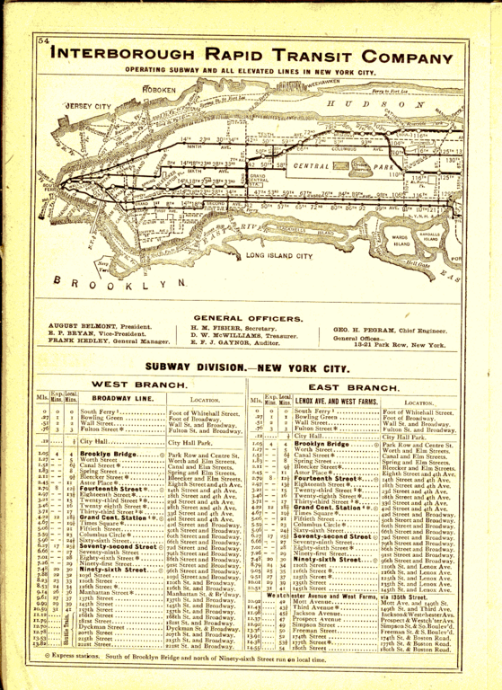
File:1906 IRT map south.png
Jump to navigation
Jump to search

Size of this preview: 436 × 599 pixels. Other resolutions: 175 × 240 pixels | 349 × 480 pixels | 559 × 768 pixels | 1,086 × 1,492 pixels.
Original file (1,086 × 1,492 pixels, file size: 404 KB, MIME type: image/png)
File history
Click on a date/time to view the file as it appeared at that time.
| Date/Time | Thumbnail | Dimensions | User | Comment | |
|---|---|---|---|---|---|
| current | 19:48, 19 July 2014 | | 1,086 × 1,492 (404 KB) | commons>GifTagger | Bot: Converting file to superior PNG file. (Source: 1906_IRT_map_south.gif). This GIF was problematic due to non-greyscale color table. |
File usage
There are no pages that use this file.