File:1720 Chatelain Map of North America - Geographicus - Amerique-chatelain-1720.jpg
Jump to navigation
Jump to search

Size of this preview: 750 × 600 pixels. Other resolutions: 300 × 240 pixels | 600 × 480 pixels | 960 × 768 pixels | 1,280 × 1,024 pixels | 2,560 × 2,048 pixels | 4,000 × 3,200 pixels.
Original file (4,000 × 3,200 pixels, file size: 2.16 MB, MIME type: image/jpeg)
File history
Click on a date/time to view the file as it appeared at that time.
| Date/Time | Thumbnail | Dimensions | User | Comment | |
|---|---|---|---|---|---|
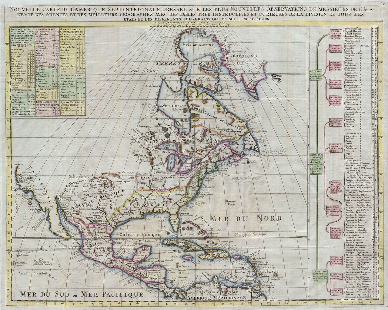
| current | 07:59, 24 March 2011 | | 4,000 × 3,200 (2.16 MB) | commons>BotMultichillT | {{subst:User:Multichill/Geographicus |link=http://www.geographicus.com/P/AntiqueMap/Amerique-chatelain-1720 |product_name=1720 Chatelain Map of North America |map_title=Nouvelle Carte de l' Amerique Septentrionale Dressee sur les plus Nouvelles Observatio |
File usage
There are no pages that use this file.