File:Карта распределения армянского населения в Турецкой Армении и Курдистане с пояснительною запискою, 1895.jpg
Jump to navigation
Jump to search

Size of this preview: 764 × 600 pixels. Other resolutions: 306 × 240 pixels | 611 × 480 pixels | 978 × 768 pixels | 1,280 × 1,005 pixels | 2,304 × 1,809 pixels.
Original file (2,304 × 1,809 pixels, file size: 1.49 MB, MIME type: image/jpeg)
File history
Click on a date/time to view the file as it appeared at that time.
| Date/Time | Thumbnail | Dimensions | User | Comment | |
|---|---|---|---|---|---|
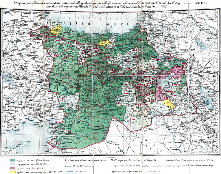
| current | 20:04, 24 March 2019 | | 2,304 × 1,809 (1.49 MB) | commons>Jacques-Yves Cousteau | Map of the distribution of the Armenian (also other Christian) and Muslim population in Turkish (Western) Armenia and neighboring regions of Ottoman empire in 1895. Map is created by general-lieutenant Zeleniy and colonel Sysoev of the military headquarter of the Russian imperial army in 1895. This map is based on the work of V. Cuinet "La Turquie d'Asie 1890-1894". |
File usage
There are no pages that use this file.